SEC504: Hacker Tools, Techniques, and Incident Handling
SEC504Offensive Operations


My previous article showed a new capability of APOLLO with KMZ location file support. It worked great - for routined data, but there was something missing. What about the cellular and Wi-Fi locations that are stored in databases? Well, turns out I need to test better. I fixed the locationd modules to have the activity as “Location” versus “LOCATION”. Case sensitivity is apparently thing in Python - my bad.
I should also mention with the fixes, my total location data points for a iOS 12.1.1 device jumped to ~57,000! I should note this is not inclusive of workout locations. Those are a bit different as they are stored as separate records, one for latitude and one for longitude. In the future I might attempt to pair these up for KMZ support.
The previous article showed the routined (user/device patterns) data, I have found these locations to be quite accurate. To be fair, I have not looked at all (40k+) of them specifically, only spot checked. When I visualized the locationd data, I saw some interesting outliers.
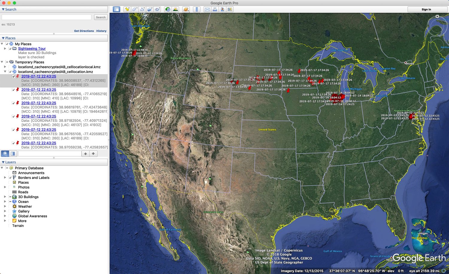
The first module I found particularly interesting is the output from the locationd_cacheencryptedAB_celllocation module. Most of the locationd output is kept for about a week. This particular week I traveled from DC to Portland via Chicago for DFRWS and then back to DC (again via Chicago). You will notice that there are some data point clusters around DC, Chicago and Portland as expected – but there are a few scattered data points in the Midwest. I do not remember for sure if my device was in Airplane Mode, but this may be an artifact of potentially being able to access cell towers during my flight. (The locationd_cacheencryptedAB_ltecelllocation module output showed a similar pattern.)
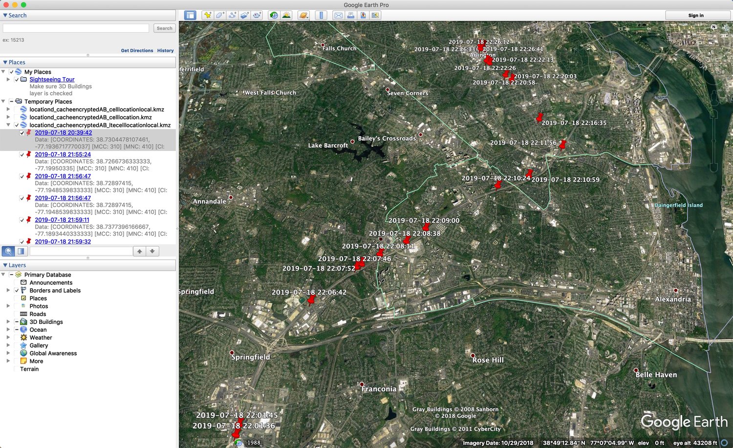
The next module, locationd_cacheencryptedAB_ltecelllocationlocal, shows my path home from fairly accurately. These locations tend to be kept for less time. I was going north on 95, past the DC Beltway (near Springfield, VA) and onto Glebe Road towards Arlington, VA. It may be hard to see in the screenshot but the airport to the right near the Potomac is DCA. Just north of that is the Pentagon and Arlington Cemetery.
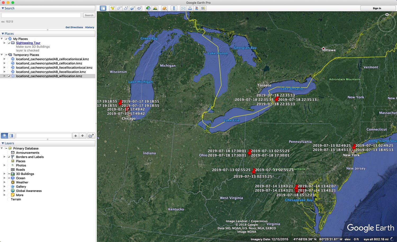
Finally, we have the output from the locationd_cacheencryptedAB_wifilocation module. This one has a few more outliers that I have a hard time explaining. I was DC and Chicago in this screenshot but not in Buffalo (NY), Pennsylvania, or NYC.
These are good examples of not completely believing and relying on what you see in the data. I can only imagine forensics cases relying heavily on this data. While I have found routined data points to be far more accurate, locationd on the other hand does have its oddities. Perhaps it is something with how the data is populated or the coordinates being reported by cell towers and/or access points. This requires additional investigation. TL;DR – Don’t assume what you are looking at is the end all be all of the data – always investigate further and correlate with other information.
In other news, if anyone knows more about how this data is populated – I’d love to know. Drop me a note!
Want to learn more? Watch Sarah's webcast on APOLLO here.
